
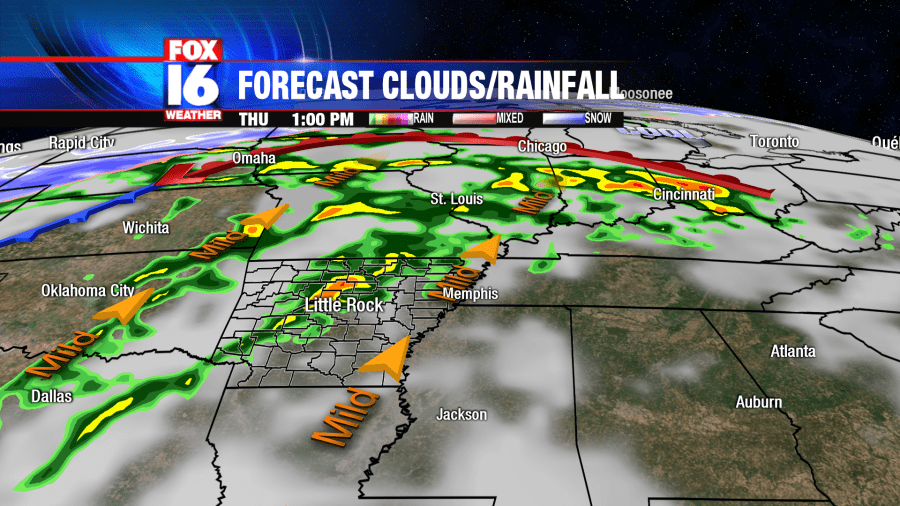
LITTLE ROCK, Ark. – Two rounds of rain and some thunderstorms are likely for Arkansas Thursday. The first round will be during the morning hours, with the heaviest rain for Northwest Arkansas where 1 to 3 inches are possible. Severe storms are not expected during the morning hours. The showers diminish later in the morning, but showers and storms redevelop late afternoon. Some storms may be strong to severe starting late afternoon through Thursday night.
Southwest wind flow increases Thursday bringing plenty of Gulf moisture and warm air into Arkansas. A cold front moving in from our west will trigger some strong to severe thunderstorms ahead of it late Thursday. General timing for central and northern Arkansas in 4pm to midnight central.
The Storm Prediction Center has included parts of northeast and central Arkansas in an ENHANCED risk (30%) outlined in orange for severe storms. This includes: Little Rock, Conway, Cabot, Clinton & Searcy. A SLIGHT risk (15%) is outlined for central and west Arkansas in yellow. This includes: Russellville, Hot Springs, Pine Bluff & Arkadelphia. A MARGINAL risk (5%) is outlined in green and includes: El Dorado, Fordyce & Camden.
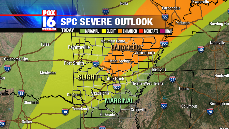
Isolated severe storms will be possible in the afternoon and early evening hours.
The primary threat is strong, damaging winds in excess of 57mph. There is a lower threat for large hail in some of the storms and an even lower threat for an isolated tornado or two.
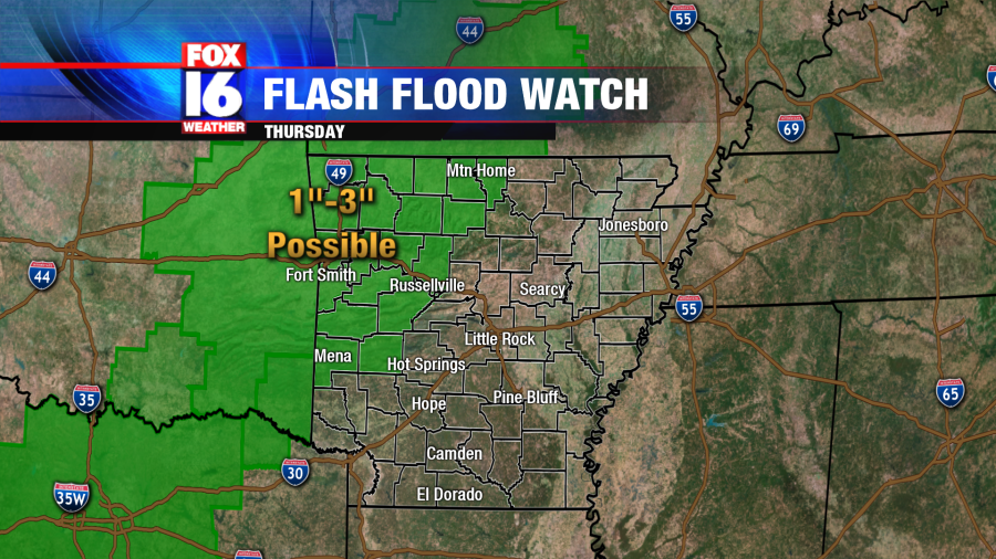
A Flash Flood Watch is also in effect mainy for parts of Western and Northwest Arkansas through 7pm cdt Thursday.
The cold front moves through early Friday morning with cooler air moving back in for the end of the week. Drier conditions are expected Friday afternoon into Saturday.


