Update:
LITTLE ROCK, Ark. – Severe weather will continue to threaten parts of Arkansas into Saturday morning.
A Tornado Watch has been extended until 6 a.m. Saturday for these counties:
Arkansas, Ashley, Bradley, Calhoun, Chicot, Clark, Clay, Cleveland, Craighead, Crittenden, Cross, Dallas, Desha, Drew, Grant, Greene, Hot Spring, Jefferson, Lawrence, Lee, Lincoln, Mississippi, Monroe, Ouachita, Phillips, Pike, Poinsett, Randolph, St. Francis and Union.
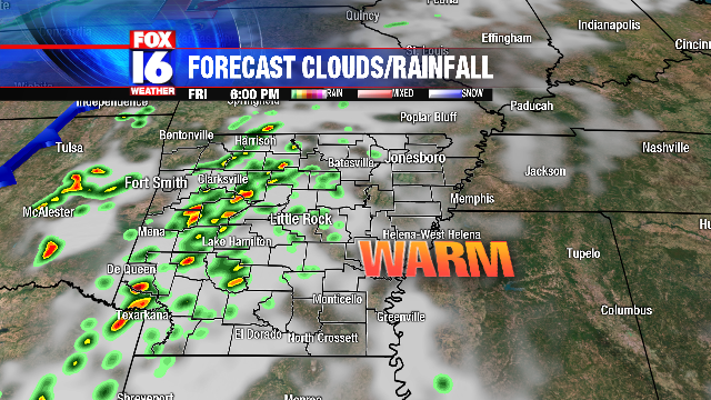
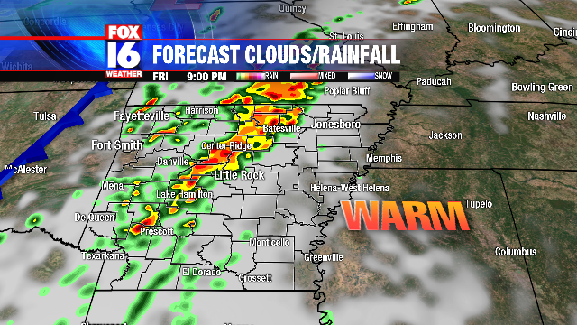
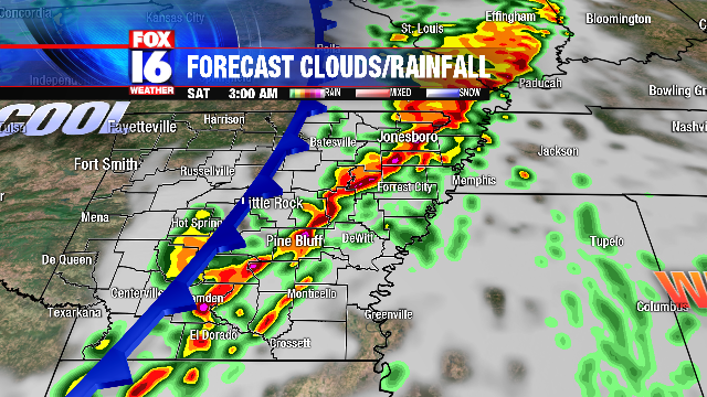
A storm system that began moving into Arkansas Friday afternoon was still slowly making its way across the state late Friday night.
Damage from a tornado was reported late Friday afternoon in Crawford County at Mountainburg. Wind damage was also reported in other areas, including near Umpire in Howard County.
Update:
LITTLE ROCK, Ark. – A Particularly Dangerous Situation Tornado Watch has been issued for much of Arkansas.
The watch has an elevated threat of strong to violent tornadoes and is in effect until 10 p.m. Friday.
The counties under the watch include: Baxter, Benton, Boone, Bradley, Calhoun, Carroll, Clark, Cleburne, Cleveland, Columbia, Conway, Crawford, Dallas, Faulkner, Franklin, Fulton, Garland, Grant, Hempstead, Hot Spring, Howard, Independence, Izard, Jackson, Jefferson, Johnson, Lafayette, Little River, Logan, Lonoke, Madison, Marion, Miller, Montgomery, Nevada, Newton, Ouachita, Perry, Pike, Polk, Pope, Prairie, Pulaski, Saline, Scott, Searcy, Sebastian, Sevier, Sharp, Stone, Union, Van Buren, Washington, White, Woodruff, and Yell.
A tornado watch is issued when weather conditions are favorable for the development of severe thunderstorms that are capable of producing tornadoes.
Update:
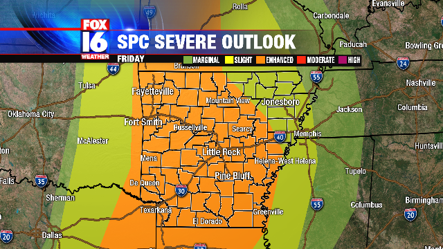
LITTLE ROCK, Ark. – Parts of Central Arkansas (Little Rock, Conway, Hot Springs, Arkadelphia) have been upgraded to a Moderate Risk for severe storms on Friday.
The rest of the state is under an Enhanced Risk.
Damaging winds, large hail, and tornadoes will be possible.
Our meteorologists say parts of Central Arkansas will have the potential to see stronger tornadoes (EF2 or greater) and very large hail (2″ diameter or larger).
A Tornado Watch is expected to be issued by around lunchtime.
Timing: Storm development is expected around 1 p.m. in Western Arkansas for the main line of severe weather. Discrete cells could develop ahead of the main line, possibly as early as 2-3 p.m. for Central Arkansas. The storms ahead of the main line will be the greater concern for tornadoes. The main line pushes into Central Arkansas between 3-6 p.m. and then pushes eastward with more of a damaging wind concern for Eastern Arkansas later this evening. The line will likely clear the state after midnight.
Update:
LITTLE ROCK, Ark. – There is an ENHANCED (30%) risk of severe weather for much of Arkansas Friday.
Hatched areas indicate a 10% chance of EF2+ tornadoes and 2″+ diameter hail.
Our meteorologists say the rough timeframe for severe weather: mid-late afternoon west, late afternoon-evening central and late evening-overnight east.
Stay weather aware Friday and check in with Fox 16 News through the day.
Original story:
LITTLE ROCK, Ark. – Friday is a FOX16 Severe Weather Alert Day..
A strong cold front pushes toward the state Friday night, triggering storm development Friday evening.
The storms will develop in an environment of strong wind shear and maximum daytime heating leading to a significant severe threat.
Individual super cell thunderstorms will begin to develop late afternoon and early evening with a large hail and tornado threat.
The storms will increase in coverage as they move into Central Arkansas later in the evening, then organize into a line overnight as they push into Eastern Arkansas.
The main severe threat will transition to straight-line winds, but some tornado threat will remain into early Saturday morning.