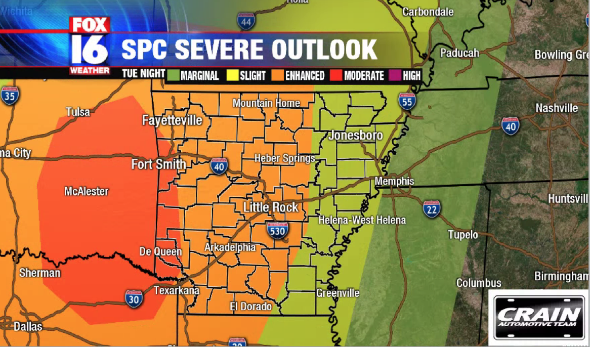
Storm Prediction Center (SPC) has upgraded west Arkansas including: Fort Smith, Mena & De Queen to a moderate risk for severe storms (45%). Little Rock and everything else highlighted in orange is still under an enhanced (30%) risk for severe storms. Eastern Arkansas is under a slight risk in yellow (15%).
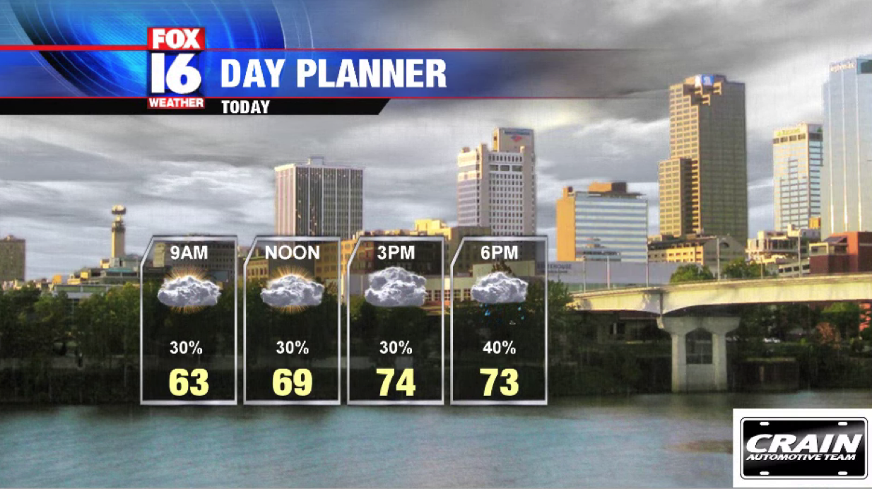
The majority of Tuesday will be relatively quiet with mostly cloudy conditions. A few isolated showers are possible later in the afternoon, but it’s really the evening & nighttime hours when activity picks up.
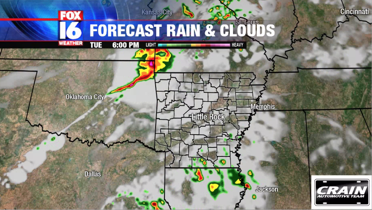
Storms begin in northwest Arkansas closer to 5pm to 7pm cdt. The biggest threat is damaging wind, but a few tornadoes cannot be ruled out along the initial line ahead of the cold front.
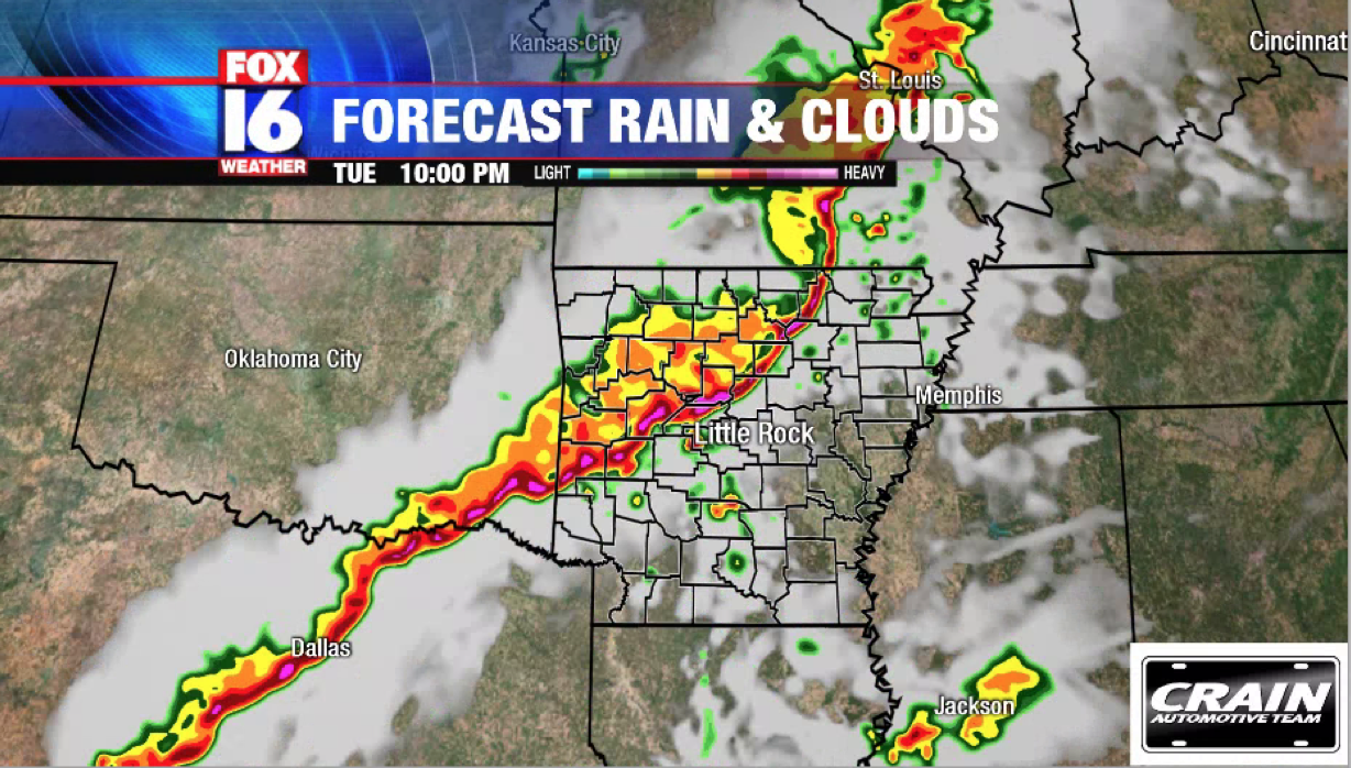
Central Arkansas and Little Rock will see strong to severe thunderstorms from 9pm to midnight cdt. Damaging wind 60mph+ could take down some trees and powerlines.
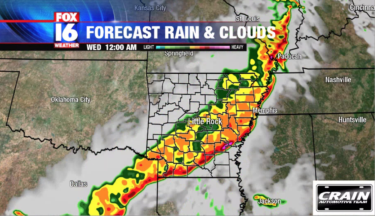
The line of storms moves into southeast Arkansas around midnight through 3am cdt, but should weaken some as it does so.
The severe weather threat should be over after 3am cdt across the entire state. The Arkansas Storm Team is tracking the latest and will have updates online here and on FOX16 News on Facebook and Twitter.
Be alerted as soon as severe weather coverage begins by downloading the Arkansas Storm Team app from the App Store or on Google Play.


