
A few strong to severe thunderstorms are possible in northeast and eastern Arkansas Monday afternoon and early evening. The largest threat with any of the storms will be large hail, although a brief, weak tornado cannot be totally ruled out.
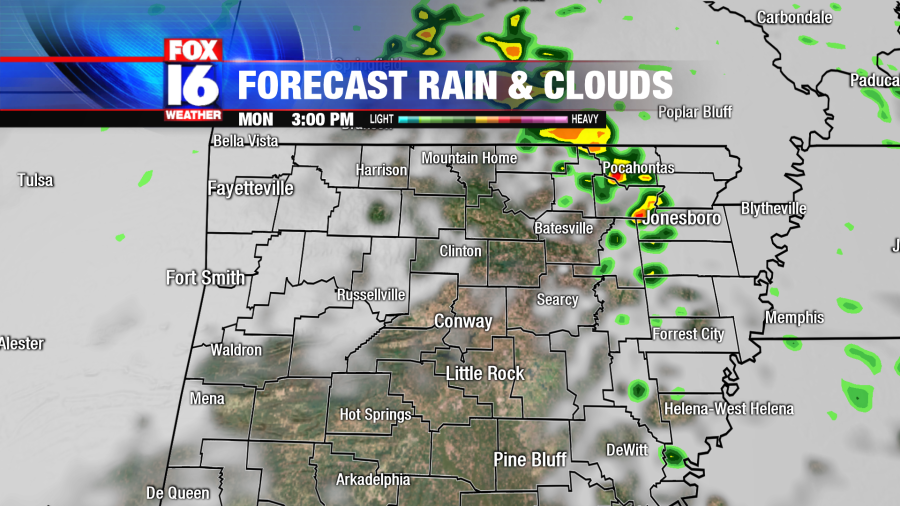
The chance for any severe weather in Little Rock is slim to none, but eastern Arkansas could see storms popping after lunch time through 5pm cst.
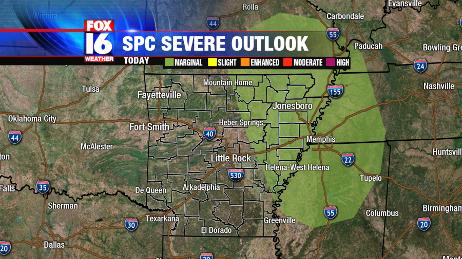
Storm Prediction Center (SPC) has Batesville, Searcy down to DeWitt under a marginal risk for severe thunderstorms. This means there is a low chance for a few thunderstorms that could become strong to severe for everything highlighted in green in the graphic below.
STORM SETUP: A low pressure system over Oklahoma will track east into Arkansas today. Ahead of the storm system, a warm front will lift through the state bringing warm temperatures in the upper 60s across central Arkansas and low 70s toward our south. The warmth and moisture in our atmosphere will provide fuel for the storms in eastern Arkansas later today.
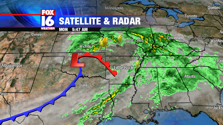
Central Arkansas will just have some light rain showers through the morning and early afternoon. These will clear after lunchtime with cooler conditions moving in tonight behind the trailing cold front.
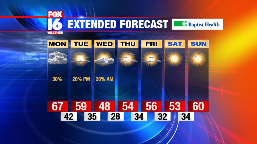
Sunshine returns during the day Tuesday with a few flurries possible late Tuesday night into early Wednesday morning. Stay with FOX16 for updates.


