LITTLE ROCK, Ark.- It comes as no surprise that summers here in Arkansas always include two things, heat and humidity.
With that being said, it is always interesting to see predictions on how much heat and rain we could be dealing with over the next three months.
Keep in mind, we are meteorologists at FOX16. We forecast the short term range which is 7-10 days. What will be shown in this article are called outlooks issued by the Climate Prediction Center (CPC) by climatologists. While meteorologists and climatologists study the same thing, weather, one looks at short term, meteorology as mentioned above, while the other looks at the long term.
The CPC attempts to predict, using past data and current trends, what we could be dealing with temperature and precipitation wise against the normal seasonal numbers. As meteorologists, we look at these to help get an idea of what our pattern will trend towards once we get within that 1.5 week range.
Let’s start with some stats, a baseline, of what Little Rock should typically see for a summer season. All data below is derived from 30-year statistical data from 1981-2010. This helps us have an idea of where numbers should be.
Average high temperature: 91.3°
Average low temperature: 71.7°
Average rainfall: 9.51″
Average number of days at or above 100°: 7
Average number of days at or above 90°: 74
Since high temperatures are what many mainly focus on, over the next three months, our normal high temperature should go from the middle 80s on June 1st to peaking out by mid-July at 93 and holding at that number through mid-August.

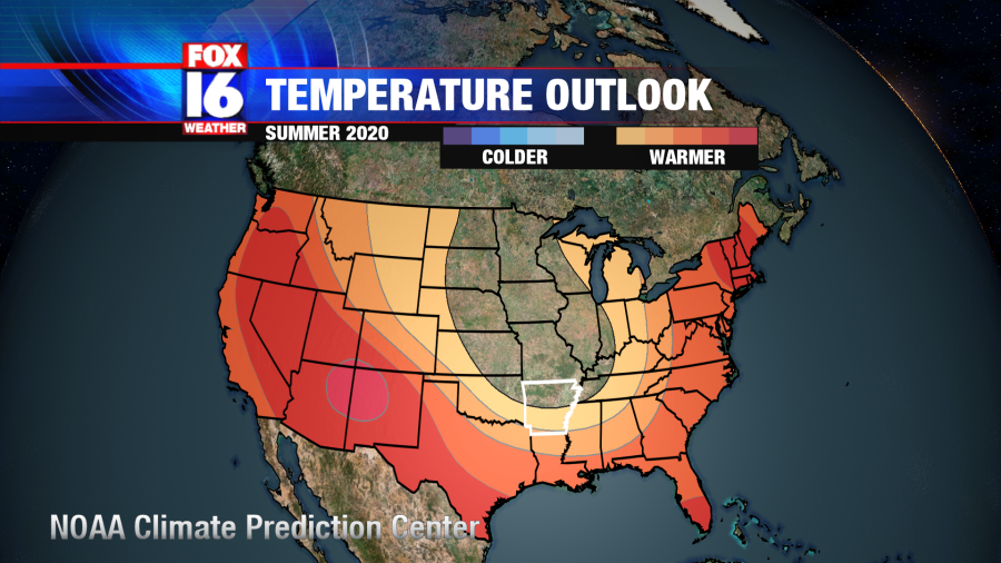
Looking ahead to the next three months, summer here in Arkansas, the CPC has placed us under near-normal temperatures or a small chance of slightly above.

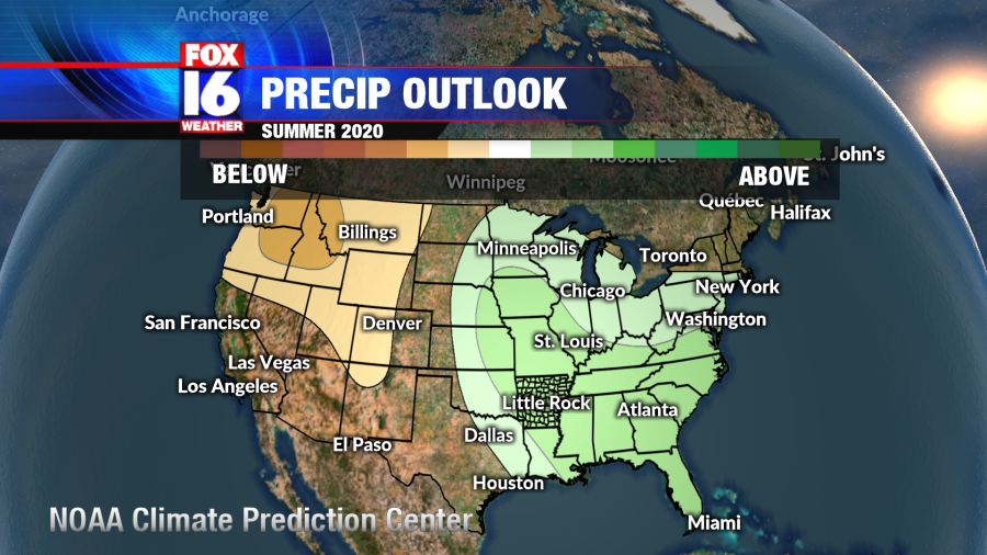
With regards to rainfall, the outlook shows us under slightly higher than normal rain activity.
Again, this is just an outlook but one that is certainly used as an idea of what we could be heading towards over the next few months. We will have to wait and see how it verifies as the weather pattern plays out.
Now, to give you an additional perspective, let’s take a look at some data from the last few Little Rock summers. There are a few interesting things to note.
| 2015 | 2016 | 2017 | 2018 | 2019 | |
| Days at or above 100° | 3 | 5 | 0 | 2 | 0 |
| Days at or above 90° | 74 | 71 | 33 | 64 | 52 |
| Rainfall | 8.08 | 16.76 | 11.47 | 12.74 | 12.61 |
If you noticed, last year, we recorded no days at or above 100° for Little Rock. If we were to do that again this year, it would be the first time we’d have two consecutive years of no temperatures at or above 100° since 1967 and 1968.
For 2020, we have dealt with plenty of rainfall for the month of May. Given how saturated the soil is, it will be pretty difficult for temperatures to reach the middle to upper 90s. That being said it will certainly feel much hotter than the air temperature with all of the humidity that will be hanging around.
As we head into the summer of 2020, here are some additional fun weather tidbits to keep in mind:
Average first 90° day: May 17 – We have not reached 90° so far this year.
Earliest 90° day: March 24, 1929
Latest 1st 90° day: June 20, 1910
Average last 90° day: September 26
Earliest last 90° day: Aug 7, 1879
Last Latest 90° day: Oct 23, 2003
Average first 100° day: July 19
Earliest 100° day: June 6, 1977
Latest 1st 100° day: September 6, 1922
Average last 100° day: August 15
Earliest last 100° day: June 29, 1988
Last Latest 100° day: September 29, 1953


