LITTLE ROCK, Ark. – What’s left of the tropical system once named Tropical Storm Cristobal continues moving northward, exiting the Natural State Tuesday morning.
Drier weather is on the way, but first, we have a very hot and humid day ahead.
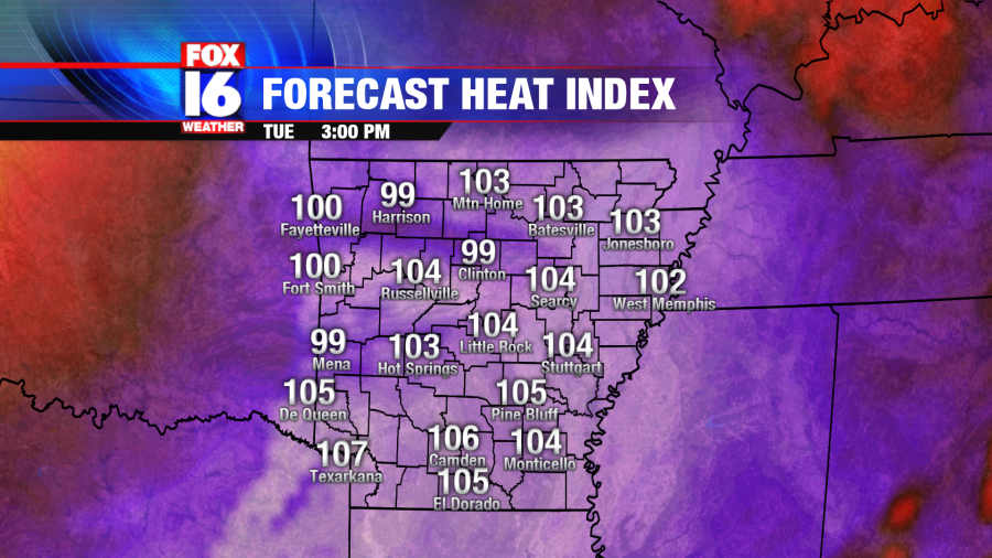
Winds will still be strong and southwesterly ahead of a cold front, allowing temperatures Tuesday afternoon to rebound into the low and mid-90’s in most locations as warm and moist air flows over the state. Factoring in the humidity, heat indices are forecast to range from 100 to 105.

Thankfully, the high heat and humidity will only last for one day.
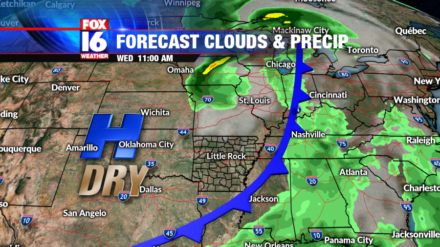
By Tuesday night and into Wednesday morning, a cold front will move across the Plains and into the Mid-South. As it clears out of Arkansas Wednesday afternoon, drier air will follow closely. Humidity will be much lower Wednesday through Friday and even remaining mild through the weekend.

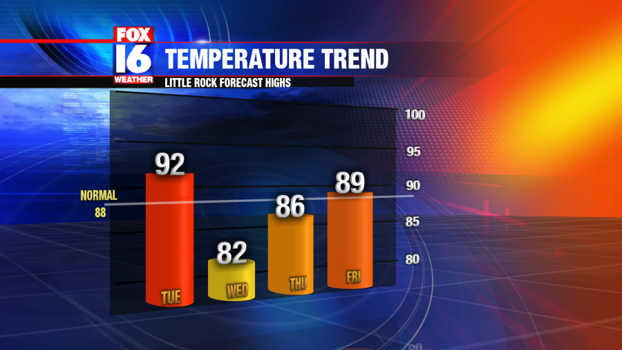
While temperatures are forecast to dip below normal (88 degrees) on Wednesday, it’s not long before they trend upwards.
A ridge of high pressure will build up across the mid-south and southeast through the end of the work week, giving way to a mostly sunny sky. Rain chances remain minimal. Meanwhile, temperatures rise back to the upper 80’s through the weekend.

To watch the latest forecast video update, click HERE.


